


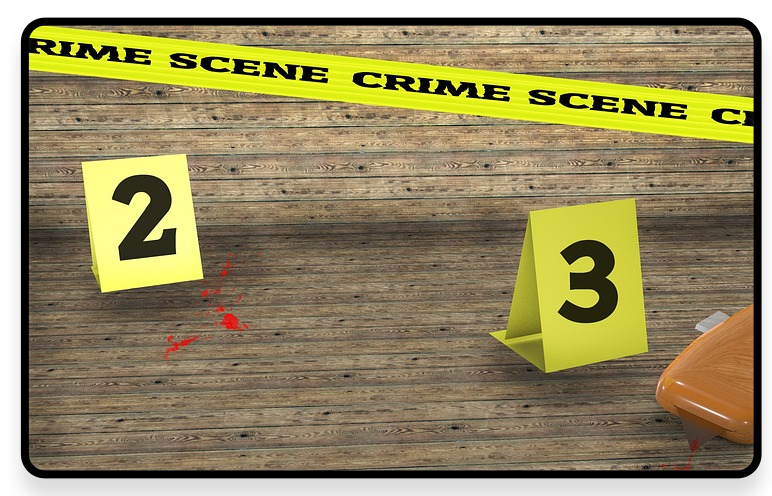
Crime Scene Reconstruction
Traditional data acquisition at crime scenes relies on manual photography, hand-drawn floor plans, and physical measurements. Data display is limited to 2D records, which make it difficult to accurately restore 3D spatial relationships (such as bloodstain patterns and ballistic trajectories), and is also inefficient. Investigations are easily affected by environmental interference (weather, human damage), manual operations are prone to missing physical evidence and subtle traces and have large measurement errors. And the decentralized management of paper materials further increases the difficulty of later analysis and collaboration, restricting the timeliness of case detection and the judicial effectiveness of evidence.
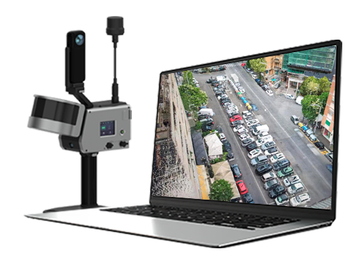
GoSLAM can be used to digitally reproduce crime scenes, quickly acquire and archive high-precision data on the scene, and automatically generate a time-space bound, tamper-proof chain of evidence. It supports collaboration between forensic, criminal investigation, and judicial departments, greatly improves the extraction rate of key physical evidence and the degree of court acceptance in cases such as homicide, theft, and arson, and reduces the risk of on-site contamination and human misjudgment.
Industry Pain Points

Timeliness and Environmental Interference
 The scene is vulnerable to weather, human damage or secondary contamination, and key evidence may be quickly lost (such as blood evaporating or traces being trampled).

Complex Space Restoration is Difficult
Traditional 2D records (photos, hand-drawings) are difficult to accurately present 3D spatial relationships (such as ballistic angles and blood splatter directions).

Destructive Evidence Extraction
Manual measurement or contact sampling may destroy original traces (e.g. fingerprints, fibers).

Risk of Subjective Error
Manual records are easily affected by the experience of investigators, resulting in omissions or misjudgments (such as unmarked physical evidence).

Inefficient Data Management and Collaboration
Scattered paper materials are difficult to integrate and analyze, and information sharing lags behind during cross-departmental collaboration.

Limitations of Evidence In Court
Planar evidence lacks 3D intuitiveness, and the jury or judge may have a misunderstanding of spatial logic.

Advantages
-
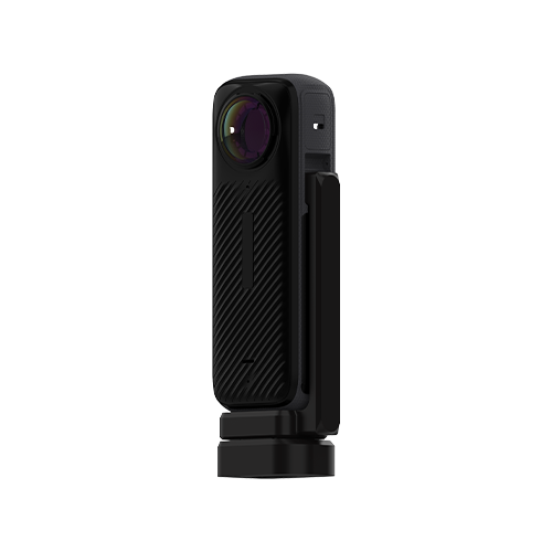
Fast and Complete On-site Records
 GoSLAM can quickly collect point cloud data to record all the details of the crime scene, providing panoramic data support for later analysis. It can also complete full-field data collection in a short time to avoid loss of evidence.

-
Data Accuracy and Integrity
Ultra-high-density scanning, ultra-large field of view, and point cloud accuracy can be up to 1cm to ensure accurate and complete data.
-
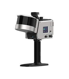
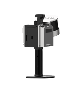
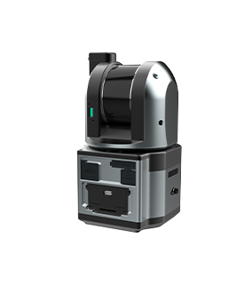
High Efficiency and Operation Mode
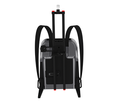
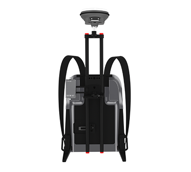
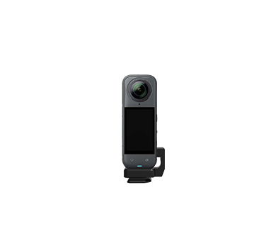
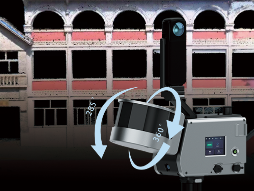
Without fixed sites, GoSLAM can generate 3D point clouds in real time while moving through a variety of mounting methods such as handheld or drone mounting. In GPS-denied scenarios such as tunnels, underground garages, and narrow ruins, GoSLAM can achieve stable positioning.
-
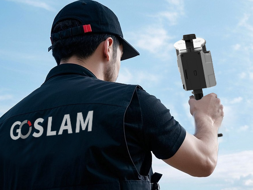
Ultra-fast Response and Efficient Operation
Small and portable, it can be operated by one person, and scanned immediately after it is turned on, quickly completing the scanning of the crime scene. The SLAM algorithm is being used to correct the trajectory drift in real time, avoiding the time-consuming point cloud stitching problem of traditional post processing.
Solutions and Related Products
GoSLAM scanner can be used to digitally reproduce crime scenes, quickly acquire and archive high-precision data on the scene, support collaboration between forensic, criminal investigation and judicial departments, significantly improve the key evidence extraction rate and court acceptance rate in cases such as homicide, theft, and arson, and reduce the risk of on-site contamination and human misjudgment.
Advantages:
■ High Precision and Data Integrity: SLAM laser scanning technology can capture subtle geometric features (such as spatial information at the crime scene and distribution of scattered objects) with much lower errors than traditional measurements.
■ Holographic Recording: Hundreds of thousands of data points are acquired in one second, covering all details such as the crime scene situation, distribution of scattered objects, on-site traces, etc., to avoid human omissions.
■ Fast and Time-saving: Rapid collection, the use of drones, robot dogs and other multi-platforms mounting methods can quickly obtain complete information on the scene over a large area, which can increase work efficiency by at least 5 times compared to traditional methods.
■ Reduce Manpower: Complex space measurements can be completed by a single operator, reducing labor costs and the risk of human error.
■ Strong Ability to Handle Complex Structures: Easily handle irregular spatial structures such as curved walls, high roofs, stairwells, etc. that are difficult to measure with traditional tools.
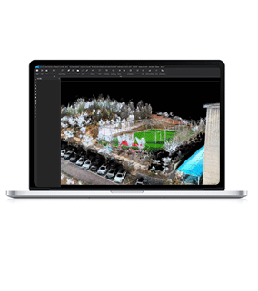
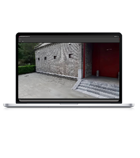
■ Digital and Visual 3D Model Generation: Directly output point cloud data, quickly generate site survey maps, roaming videos, on-site animation simulations, etc. through point clouds, and provide complete on-site conditions and physical evidence.
■ Data Concatenation: The platform enables remote viewing, assists in crime scene restoration and reporting analysis, and preserves the entire chain of accident scene data (panoramic images, spatial point clouds, transcripts, videos, etc.).

Workflow

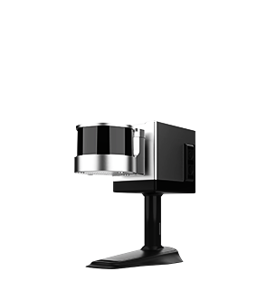
Data Collection
Assemble and power on the device, then use a mobile phone to remotely control the device for mobile data collection.
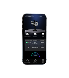
Data Processing
The device can be controlled to perform internal processing and automatically process data by the APP.
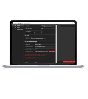
Result Export
Data can be exported via USB, network cable or WiFi.