


Forestry Growth Measurement
With the development of science and technology, forestry growth surveys have put forward higher requirements on the accuracy, efficiency and functionality of measurement tools. For example, traditional methods are difficult to accurately measure the three-dimensional structure of trees, the spatial distribution of trees, and the detailed information of forest vegetation.
In addition, forestry surveys also need to cope with complex and changing field environments, and traditional tools lack stability and portability.
Industry Pain Points

Complex Terrain and Difficult To Measure
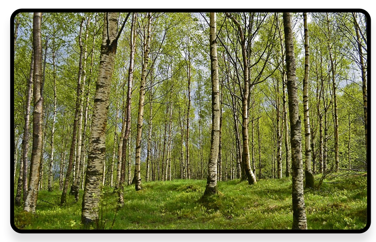
 The forest area has diverse terrain, including mountains, hills, canyons, etc. Traditional surveying equipment is difficult to reach or operate in these complex terrains, resulting in difficulties in data collection.

Dense Vegetation Affects Data Acquisition
The vegetation in the forest is dense and the branches and leaves are seriously obstructing the view. Conventional measurement methods such as total stations and GPS are easily affected by signal interference, making it difficult to accurately obtain data such as tree location, height, and breast diameter. And it is impossible to fully obtain the 3D spatial information of the forest.

Inefficient Investigation
Forestry surveys cover a wide range and involve many items, such as tree resource inventory and forest stock calculation. Traditional manual survey methods are time-consuming and labor-intensive, with high work intensity and low efficiency, and are difficult to meet the needs of large-scale and rapid surveys.

Insufficient Data Accuracy
Manual measurement is prone to errors, and traditional measurement methods are difficult to accurately measure some complex forest structures and terrain changes, resulting in low accuracy of survey data, which affects the accuracy of subsequent forest resource assessments and management decisions.

Data Result is Single
It is not possible to locate individual trees quickly and accurately.

Advantages
-
Adapt To Complex Terrain
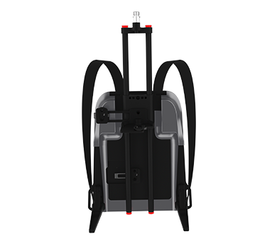
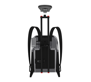
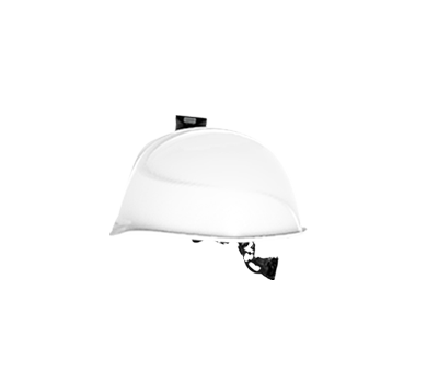
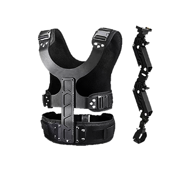
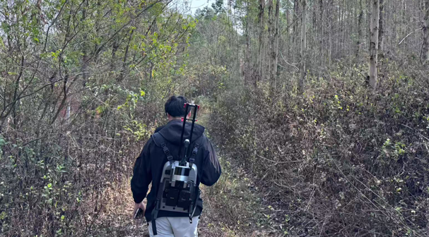
 The device is portable and can be held or carried on the back. It can flexibly travel through complex terrains such as mountains and hills and reach areas that are difficult for traditional equipment to reach. At the same time, it has a high level of protection and weather resistance, can adapt to various severe weather and field environments, and ensure that it can work normally under different conditions.
-
Obtaining Data Through Vegetation
The advanced laser scanning technology can penetrate some vegetation and obtain accurate information about the terrain and trees under the forest. It can clearly distinguish the location, shape, height and other characteristics of the trees.
-
High Efficiency
Acquiring a large amount of 3D spatial data in a short period of time greatly improves the survey efficiency compared to traditional manual survey methods. It can complete large-scale forestry survey tasks in a shorter period of time, saving manpower and time costs.

-
High Precision Measurement
The equipment is equipped with high-precision laser probes and advanced positioning systems, which can accurately measure various parameters of trees and subtle changes in terrain, providing reliable data support for accurate assessment and scientific management of forest resources.
-
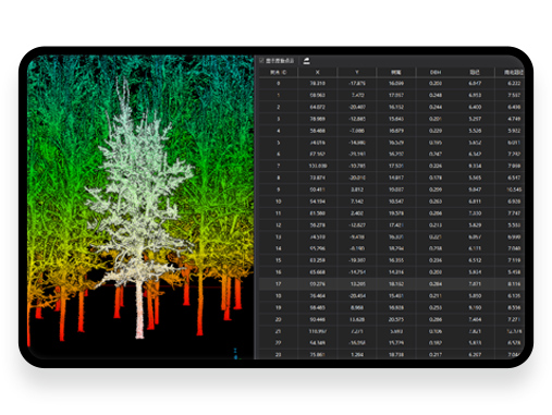
Data Results are Intuitive
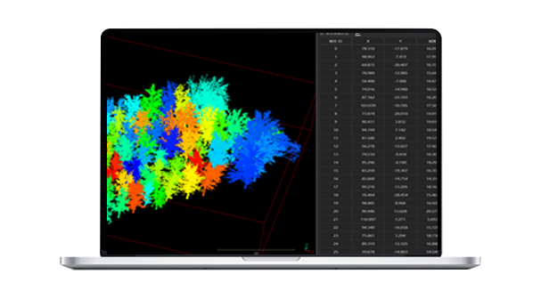
The results are more complete, accurately locating the crown width, breast diameter, and xyz coordinates of each tree.
Solutions and related Products
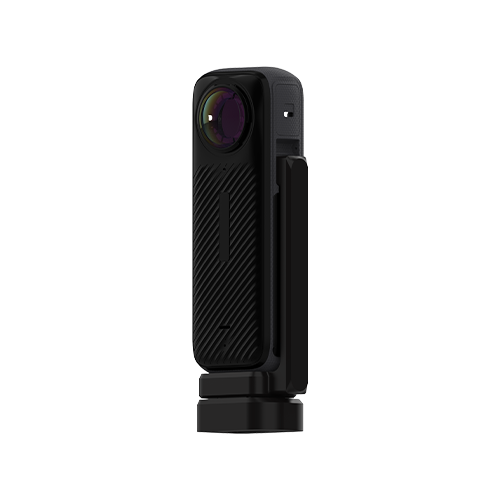
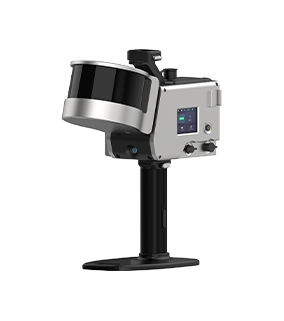
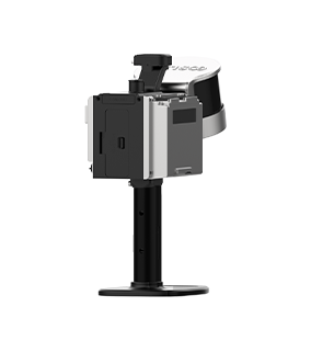
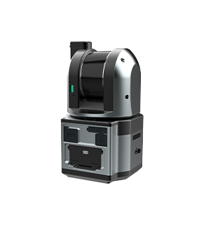
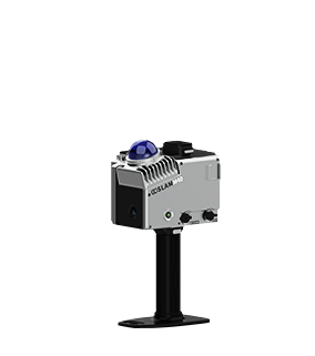
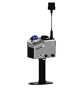
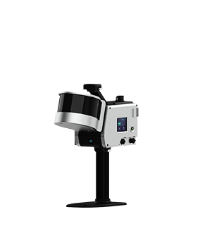
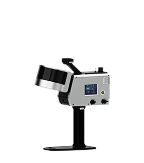
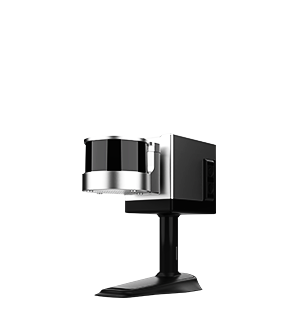
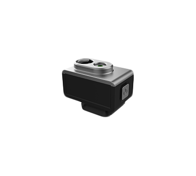
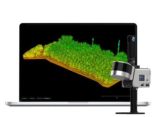
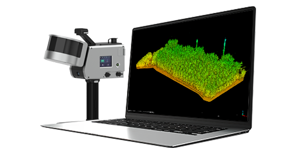
The GoSLAM mobile measurement system 3D scanner has significant advantages in the field of forestry growth surveys and has achieved fruitful results. It can quickly and accurately obtain data such as tree location, height, and breast diameter, generate a 3D point cloud map, and greatly improve the efficiency and accuracy of forest volume calculation.
■ No external positioning device is required. SLAM technology is being used and it does not rely on external positioning devices such as GPS, which enables it to work stably even in environments with weak GPS signals such as forests.
■ High Precision and High Efficiency: High-precision point cloud data can be quickly acquired with a scanning frequency of hundreds of thousands of points per second. The scanning distance can reach 300 meters and the point accuracy can reach 1 cm, reducing manpower investment, lowering costs and increasing efficiency.
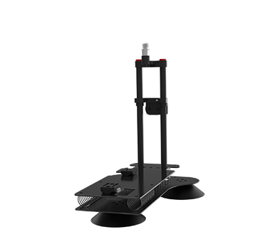
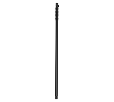
■ Multi-platforms Mounting and Flexibility: GoSLAM devices support multiple mounting modes such as handheld, backpack, car-mounted, drone, and USV-mounted. This flexibility enables it to easily cope with complex terrain and forestry survey tasks of different scales.
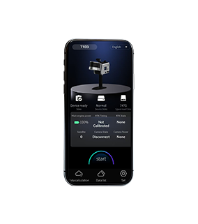
■ Real-time Preview and Data Processing: Through the mobile app or touchable screen, users can preview point cloud data in real time during the operation to ensure the accuracy and completeness of the data.
■ Strong Weather Resistance: GoSLAM equipment has good weather resistance and can operate stably in an environment of -30℃ to 60℃, making it suitable for forestry measurements in different seasons and climatic conditions.
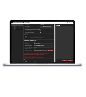
■ Supporting Single Tree Segmentation Software: GoSLAM LidarWorks supports single tree segmentation based on point cloud without third-party software.
Workflow

Data Collection
Assemble and power on the device, then use a mobile phone to remotely control the device for mobile data collection.
Data Processing
The device can be controlled to perform internal processing and automatically process data by the APP.
Result Export
Data can be exported via USB, network cable or WiFi.