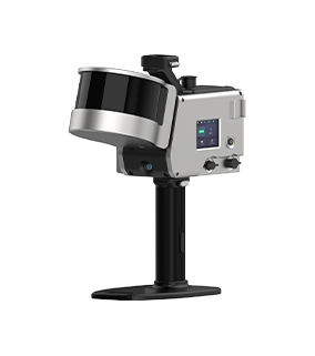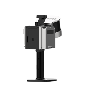
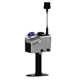

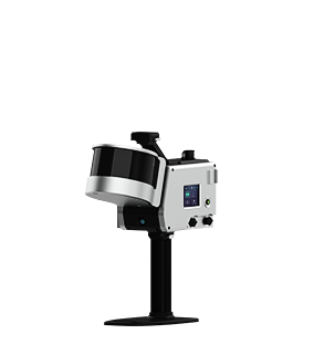
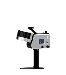

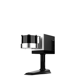


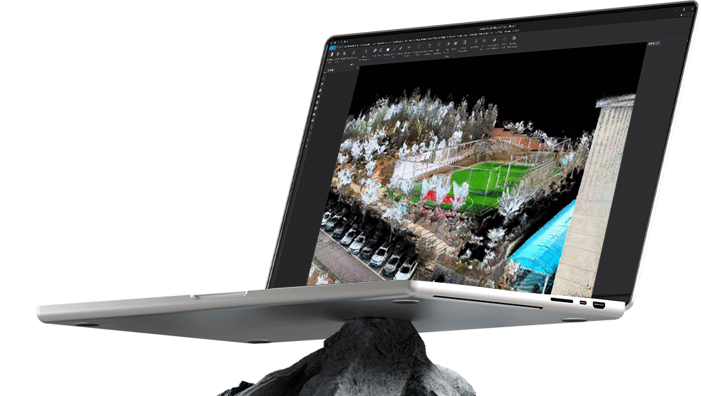
Point Cloud Data All-Round Helper
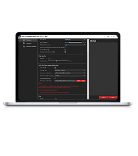
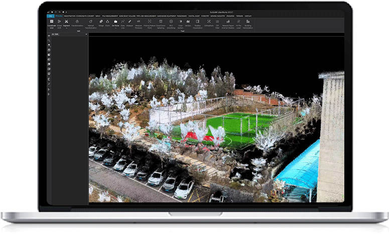
GoSLAM LidarWorks
From Basic Cutting To Professional Module Function Optimization, It Helps Your Point Cloud Data To Have A New Lease Of Life
Function Summary
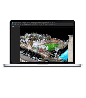
GoSLAM LidarWorks point cloud processing software is a professional general point cloud editing and application software
 Supports massive point cloud browsing, cropping, noise reduction, smoothing, coordinate conversion, stitching and other basic functions
Support model encapsulation and optimization
Interaction between panoramic pictures and point cloud as well as various industry application modules
When processing GoSLAM scanner data, you can also enjoy convenient operations such as automatic recognition of supporting files
Main Function
Cropping
The selected entity can be split by drawing a polygon. This process can be repeated multiple times, and the point cloud orientation can be adjusted at any time to accurately cut the point cloud.
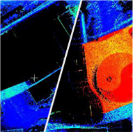
Global Registration
The global registration function can match data with high precision, support common area selection, greatly reduce the participation of irrelevant data in calculations, improve matching speed and accuracy, and reduce processing pressure.
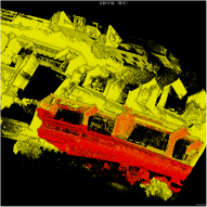
Noise Reduction
The denoising function is divided into two modules, statistical filtering and noise filtering.
Statistical filtering can effectively reduce discrete noise points on the data by filtering discrete points.
Noise filtering is optimized for the main structure of the data which can effectively optimize the point cloud data of the main structure.
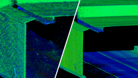
Smoothing
The smoothing function is used to optimize the point cloud thickness of SLAM data, and can optimize a point cloud with a thickness of several CM into a single-layer point cloud.
Slicing
The slicing function can generate standard section data and freely set the slice thickness in any axial direction to help with data checking and plan drawing.

Industry Modules
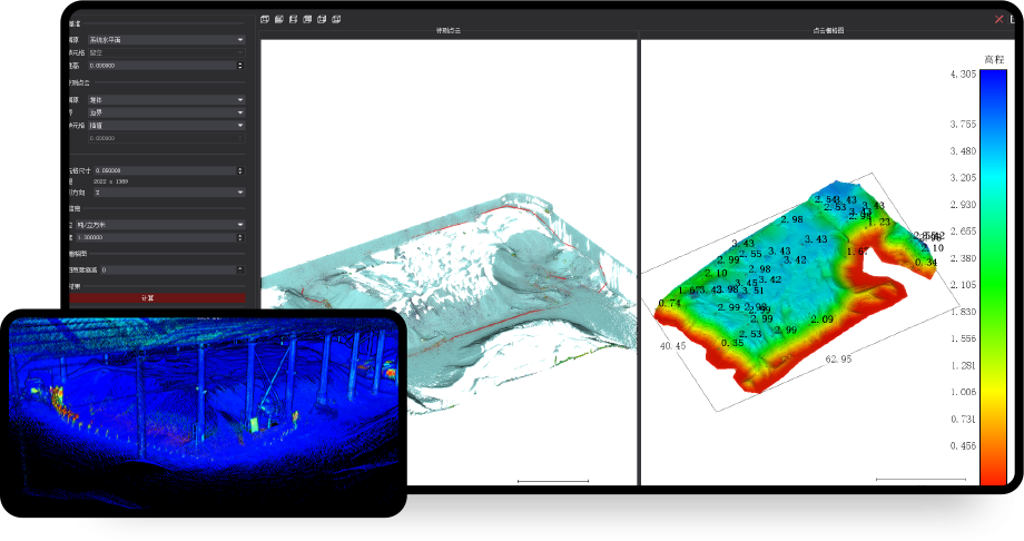
Pile Metering Module

According to the point cloud, the one-dimensional model of the pile can be accurately fitted or the point cloud data can be directly used to realize the rapid volume calculation. One-click volume measurement can automatically measure the point cloud without model encapsulation, and the sinking plane can be customized to generate volume, surface area and other values.
Main Functions Including:
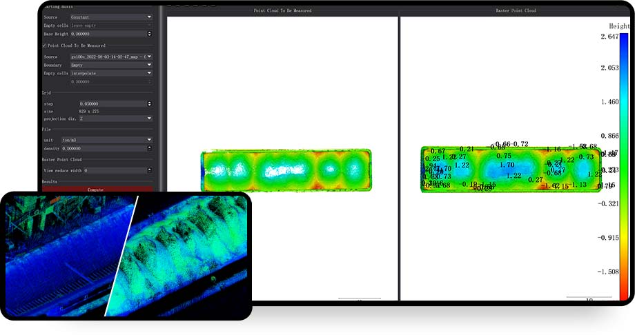
Sand Boat Measuring Module
An accurate empty-storage volume database can be established by scanning the empty-storage point cloud of the sand ship. Later, the collected full-load point cloud data can be combined with the empty-storage data to obtain the volume of sand and gravel transported by the complete sand ship. The data chain is complete and can be used for related applications such as water law enforcement as well as be used for basic sand ship capacity data acquisition and statistics.
Main Functions Including:
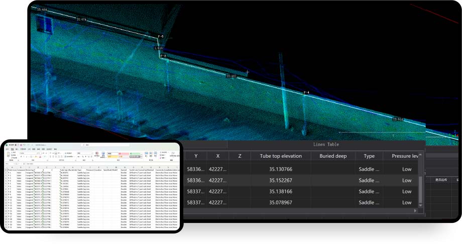
Pipeline Measurement Module
The pipeline measurement module is mainly used for
digital statistics of gas pipelines.It can use the pipeline system point cloud scanned by field personnel to directly draw a point and line table.It can automatically generate a line table by selecting points, extract coordinates and burial depth information, and support data archiving in project form to ensure data integrity and easy search.It can be viewed and modified at any time and supports outputting an Excel format point and line table for submitting result data.
Main Functions Including:
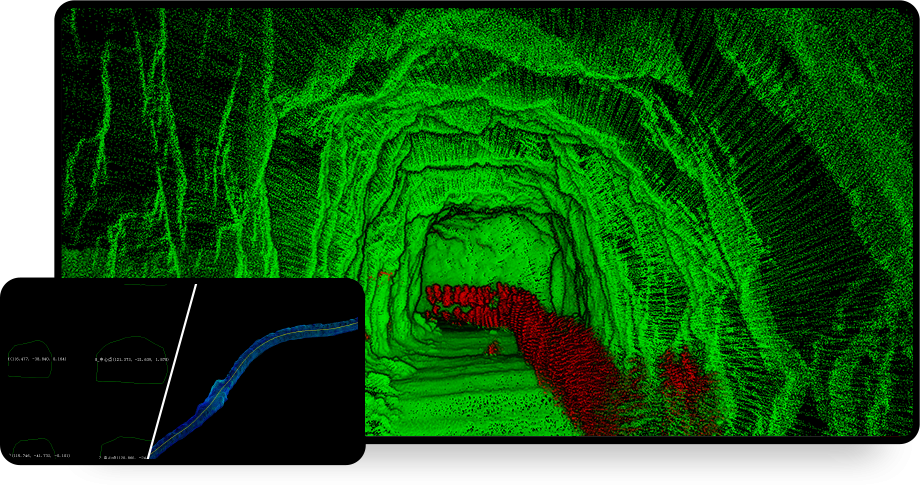
Mining Module
The functions of the mining module include three major functions: mine extraction, central axis extraction and section extraction, which can quickly identify the facilities, equipment and personnel and other structures in the mine through intelligent analysis, and separate them from the main body of the mine, so as to facilitate the analysis of the main body of the mine, model encapsulation, volume measurement, etc., and quickly
obtain the central axis of the tunnel, slice the mine to form a dense section, which can be used for the analysis of over-under-excavation and local deformation in the later stage.
Main Functions Including:
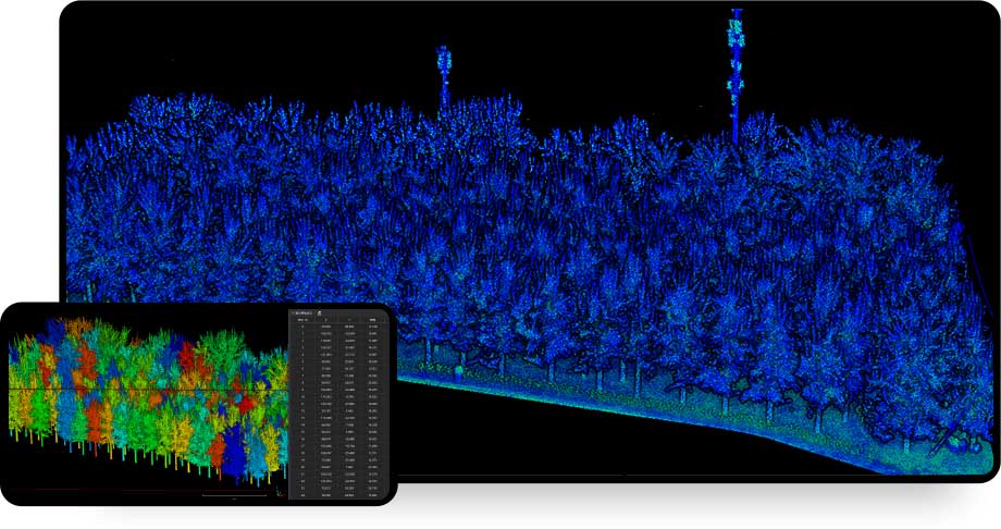
Forestry Module(Optional)
Automatically extract DEM data by one-click to generate tree attribute by obtaining single wood parameters such as tree height, chest diameter and crown diameter. Automatically distinguish vegetation information, divide each vegetation for single wood and display it according to different colors for more convenient to calculate the number of vegetation plants.
Main Functions Including:
Pile Metering Module
According to the point cloud, the one-dimensional model of the pile can be accurately fitted or the point cloud data can be directly used to realize the rapid volume calculation. One-click volume measurement can automatically measure the point cloud without model encapsulation, and the sinking plane can be customized to generate volume, surface area and other values.
Main Functions Including:
Sand Boat Measuring Module
An accurate empty-storage volume database can be established by scanning the empty-storage point cloud of the sand ship. Later, the collected full-load point cloud data can be combined with the empty-storage data to obtain the volume of sand and gravel transported by the complete sand ship. The data chain is complete and can be used for related applications such as water law enforcement as well as be used for basic sand ship capacity data acquisition and statistics.
Main Functions Including:
Pipeline Measurement Module
The pipeline measurement module is mainly used for
digital statistics of gas pipelines.It can use the pipeline system point cloud scanned by field personnel to directly draw a point and line table.It can automatically generate a line table by selecting points, extract coordinates and burial depth information, and support data archiving in project form to ensure data integrity and easy search.It can be viewed and modified at any time and supports outputting an Excel format point and line table for submitting result data.
Main Functions Including:
Mining Module
The functions of the mining module include three major functions: mine extraction, central axis extraction and section extraction, which can quickly identify the facilities, equipment and personnel and other structures in the mine through intelligent analysis, and separate them from the main body of the mine, so as to facilitate the analysis of the main body of the mine, model encapsulation, volume measurement, etc., and quickly
obtain the central axis of the tunnel, slice the mine to form a dense section, which can be used for the analysis of over-under-excavation and local deformation in the later stage.
Main Functions Including:
Forestry Module(Optional)
Automatically extract DEM data by one-click to generate tree attribute by obtaining single wood parameters such as tree height, chest diameter and crown diameter. Automatically distinguish vegetation information, divide each vegetation for single wood and display it according to different colors for more convenient to calculate the number of vegetation plants.
Main Functions Including:
System Configuration Requirements
-
PC
CPU11th generation i7 or above
Memory32G or above
GPU1070Ti or above
-
Desktop Computer
CPU10th generation i5 or above
Memory32G or above
GPU1070Ti or above
*Computer configuration and hard disk capacity can be selected according to the amount of data processed at a time. The above specific models are the configurations required for pan coal and small-scale data processing. Users who involve multi-data splicing or large-scale data processing should improve the configuration by themselves.